Continued from Part I ...
RAJGAD
Kick-started my bike, and was on my way by 5:30am sharp. As expected, the windchill was killing me. After a couple of stops, one of which was for petrol, I reached Gunjavane by 7:15am, and immediately started towards Rajgad. The sun had just risen, and birds were out chirping, sun-bathing and foraging. I had to ignore birding today. As much as possible. There was a schedule to stick to and it was driving me. Sometimes when you see a Shikra or a Kestrel though, the temptation is just way too much.
I had set a mini-timeline to reach the Rajgad top by 9:15am so that I would have some buffer to find the Alu Darwaja and figure out the way out on the ridge. I could also eat something for breakfast with some extra time on my hand.
I kept going, taking merely a single break along the route, and to my surprise, went through the Chor Darwaja and reached Padmavati Machee at 8:45am itself. 1.5hrs for the same Rajgad trek that used to take me 2.5-3hrs couple of years back. That too with a 15kg backpack on my shoulders. That had to be a personal record of sorts.
10am was the magic figure, and I was running almost an hour ahead of that schedule. So I had all the time to go after a pair of Kestrels that I spotted sitting on a wire alongside a tank, and also to eat some breakfast, before I would set out to find the Alu Darwaja.
|
|
|
 |
| Board on Padmavati Machee giving directions |
After photosession with the Kestrel was over, I started out towards Sanjivani Machee. That is where the Alu Darwaja is located. Sanjeevani Maachee is almost an hour's walk from Padmavati Machee. There are few water cisterns apart from the still-in-good-shape fortifications. I walked on the Machee, inside the double-curtain fortifications, which by the way are quite impressive, in search of the Alu Darwaja. But even after reaching the final vantage point of Sanjeevani Machee, Alu Darwaja was nowhere to be found.
 |
| Sanjeevani Machee |
I had an inkling that this was the route going out from Rajgad, and where it ends on the left of Sanjeevani Machee, would be the Alu Darwaja. I climbed the fortification, started walking on it following the dirt walkway below the Machee. I came to a point where walking further on the fortification would have been nothing short of harakiri due to loose stone and gravel all around. There was not a single human being in sight there to ask directions to.
It was almost 10:20am by that time, and I was quickly running out of time. All the advantage of time I had got initially, would be wasted if I wouldnt find the way out quickly. I was below the first observation point on Sanjeevani Machee, and on the right side I saw a small opening. I was sceptical but followed it just for the sake of checking it out, and viola! There was an opening further, went through that opening and there I was - emerging out of the double-curtain fortification and out of Rajgad, in the open! So that was Alu Darwaja. Hmmm, pretty darn deceitful and well hidden.
THE RIDGE
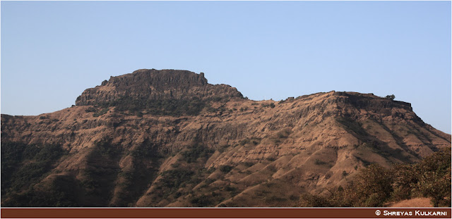
Bravo! So I was finally out on the terrain, and it was 10:30am in the morning. Not much behind the schedule. Keeping the Sanjeevani Machee on my right, I walked for some distance before I came right below its final vantage point. From here I took right, and the vast ridge that connects Rajgad to Torna, was right in front of me. At the end of it, was the pinnacle of Budhala Machee that would be my beacon and guide for the rest of the journey while I would make my way on the ridge.
 |
| The Ridge |
After around an hour of walking, at around 11:30am I came inside this dense scrub jungle. The route was passing through a net of green scrubs, so dense that it was dark and cold beneath when it was a hot sun overhead. I decided to have my lunch there beneath a small aromatic flowering scrub which had beautifully scented flowers. The dark, the cold, the scent - it was plain surreal. By 12:15pm I was done with my lunch, and was ready to go once again.
In about 10 mins of walking, suddenly the tar road of Kolhe Khind appeared. Crossed the tar road, got some दही-साखर (sugarated curd) at the hut. While eating that sour-sweet curd, I had a small chitchat with the lady of that hut. They are the only family leaving in that area, and though there hasn't been an issue of leopards or other wild animals, source of drinking water is very distant from there. It was the lonely family of four, somehow sustaining in that jungle, where even drinking water is luxury! Life people live.
|
|
 |
| The Moss - Leftovers of a long rainy season |
The Budhala Machee pinnacle was quite close by now, while Rajgad was suddenly distant. It was 1:30pm and I was growing restless about the 3pm deadline to reach Budhala Machee. I picked up pace to reach there in time. Couple of photography distractions did slow me down en route, but by and large, I was on time and doing well.
Continued to Part III ...


No comments:
Post a Comment